Kinder Scout
The 1932 mass trespass
On 24 April 1932, a group of ramblers — mostly young factory workers from Manchester, organised by the British Workers' Sports Federation and led by 20-year-old Benny Rothman — walked from Hayfield up onto Kinder Scout in deliberate defiance of the private grouse-shooting estates that controlled almost all access to the moor. Contemporary reports of the numbers involved vary widely, from around 100 in a Times report to Rothman's own estimate of 600–800; a commonly cited figure is around 400 walkers. Five trespassers, including Rothman, were arrested and given prison sentences of two to six months for offences including riotous assembly — sentences that were widely seen as disproportionate and helped turn public opinion in favour of open access.
Getting onto the plateau
Kinder Scout is a flat-topped plateau, not a single summit you walk to a point and photograph — its highest ground, Kinder Low, sits at 636 m and is marked by a modest trig-adjacent cairn rather than a dramatic peak. There's no one "correct" route up; the three most walked are:
- Jacob's Ladder from Edale — the classic Pennine Way approach, a stone-pitched zigzag path climbing from the Vale of Edale onto the plateau's southern edge, roughly 8 miles/13 km return.
- Grindsbrook Clough from Edale — a rockier, steeper direct ascent following the brook, popular with the same start point as Jacob's Ladder.
- William Clough from Hayfield — follows the actual 1932 trespass route more closely, climbing past Kinder Reservoir.
What the terrain is actually like
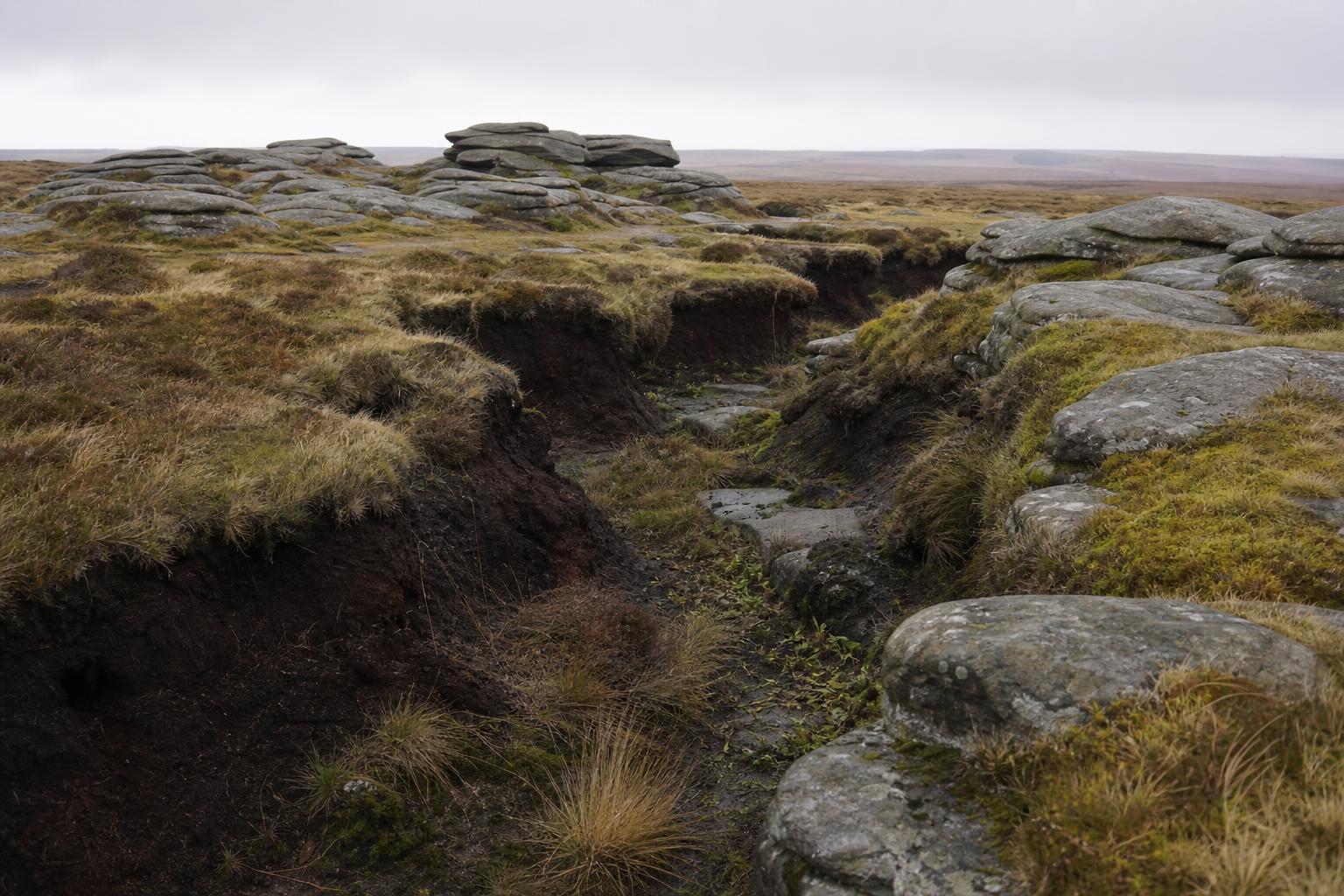
Once on top, the ground is peat hag and groughs — deep, eroded channels cut into blanket bog, some over head height — rather than open grass. Sphagnum moss cover means it's genuinely wet underfoot for most of the year, and in low cloud the flat, feature-poor plateau is a well-documented place for inexperienced walkers to lose their bearings; mountain rescue teams in the Peak District log Kinder-related callouts most years. A map, compass, and the confidence to use them (or a downloaded GPS track) matter more here than on a route with a single visible ridge line to follow.
Practical notes
Edale is on the Manchester–Sheffield Hope Valley railway line, which makes this one of the few Peak District walks genuinely practical without a car. Parking at Edale village and at Bowden Bridge (Hayfield) is limited and fills early on weekends; the Hayfield pay-and-display car park is the more reliable option for the William Clough route. There's no shelter, water source, or phone signal across most of the plateau — carry both.